My property
Search an address, use the swipe tool or download a site report.
The proposed Kawana Waters Local Plan Area (LPA) is located centrally on the Sunshine Coast along the coastline, south of the Mooloolah River and north of Currimundi Lake. It reflects the existing coastal suburbs of Buddina, Minyama, Parrearra, Mountain Creek (Brightwater), Warana, Bokarina, Birtinya, Wurtulla and Meridan Plains (Kawana Forest Estate). The proposed local plan area also includes Kawana Shoppingworld, the developing Kawana Town Centre and the Sunshine Coast University Hospital.
Click on the coloured dots in the map below to see some of the proposed planning scheme changes specific to the Kawana Waters Local Plan Area (LPA).
These coloured dots give a short summary of some of the proposed changes, including land use, building height and minimum lot size. Not all proposed changes can be shown on this map and you are encouraged to find out more.
There are significant opportunities for further growth and development in this local plan area due to proximity and accessibility to retail, business and health services and infrastructure investment (including planned public transport improvements). Constraints to further development include flooding associated with the Mooloolah River, coastal hazards, and current transport infrastructure capacities.
The Sunshine Coast is included in the State Government’s South East Queensland Regional Plan 2023 (SEQ Regional Plan). This plan includes an Urban Footprint, which outlines the State Government’s preferred location for our region’s future urban development. The proposed planning scheme also encourages compact urban growth near jobs, services, entertainment and recreation, connected by existing and planned high frequency public transport.
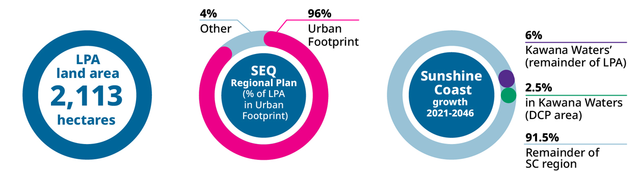
Explainer: This infographic shows how forecast population growth for the Sunshine Coast may be shared across the region by local plan area. These estimates are based on the proposed planning scheme zones and height limits.
Go to the My property Have your Say webpage to:
View the proposed planning scheme text and interactive mapping in ePlan, including the Kawana Waters Local Plan.
Read the proposed planning scheme supporting information sheets.


